BART
Santa Teresa County Park and Calero Creek
September 6, 2013 09:30
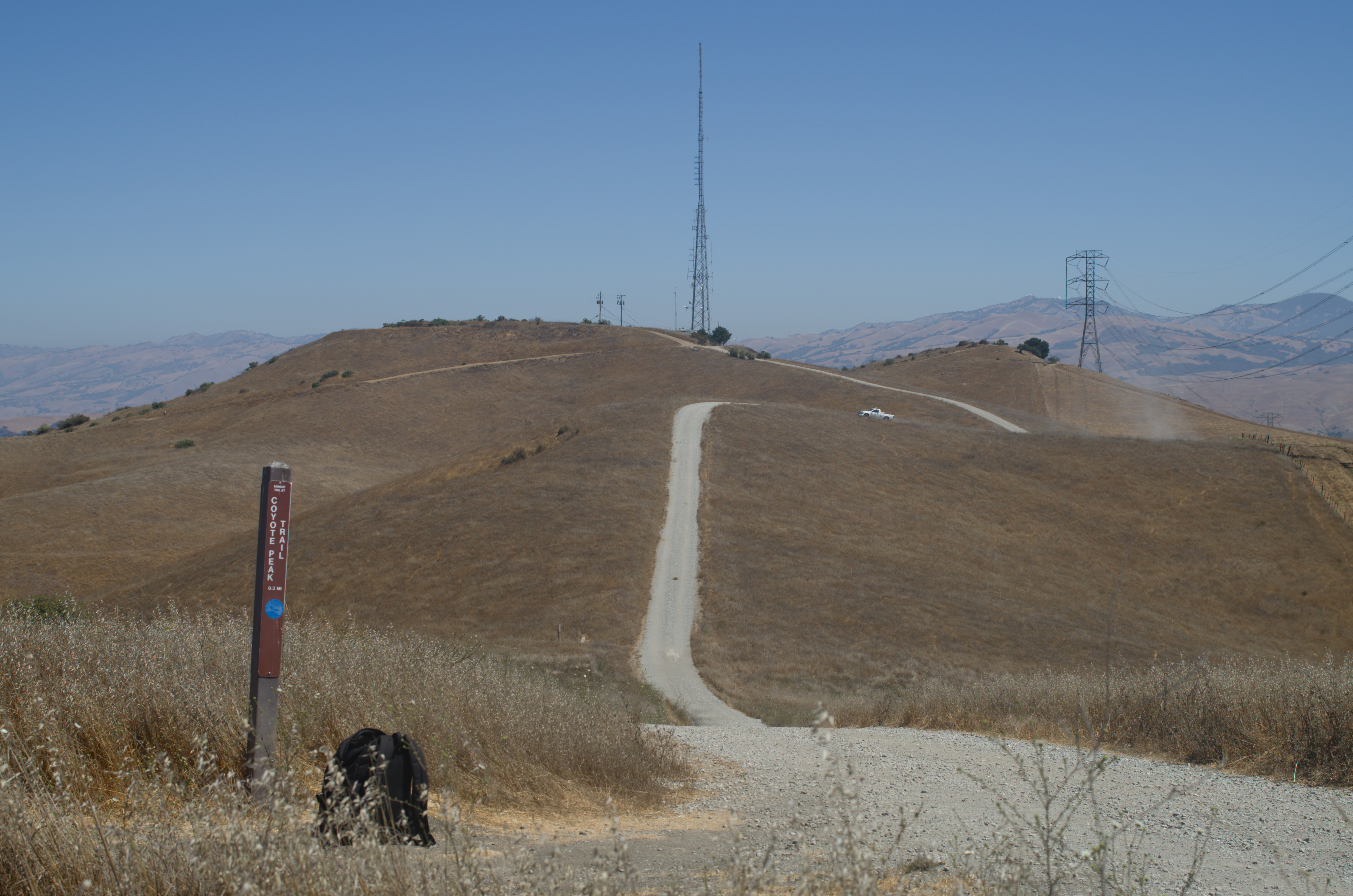
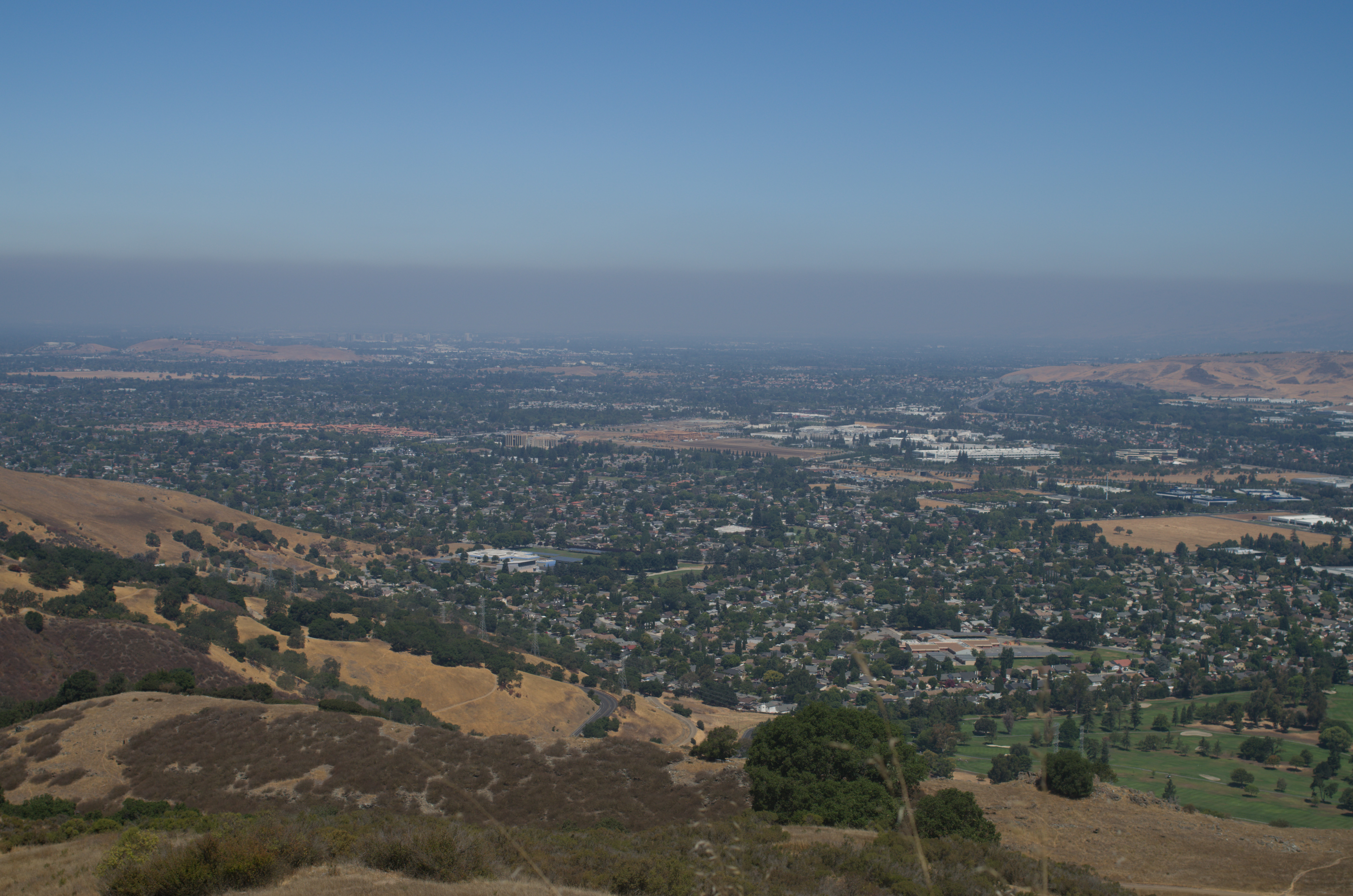
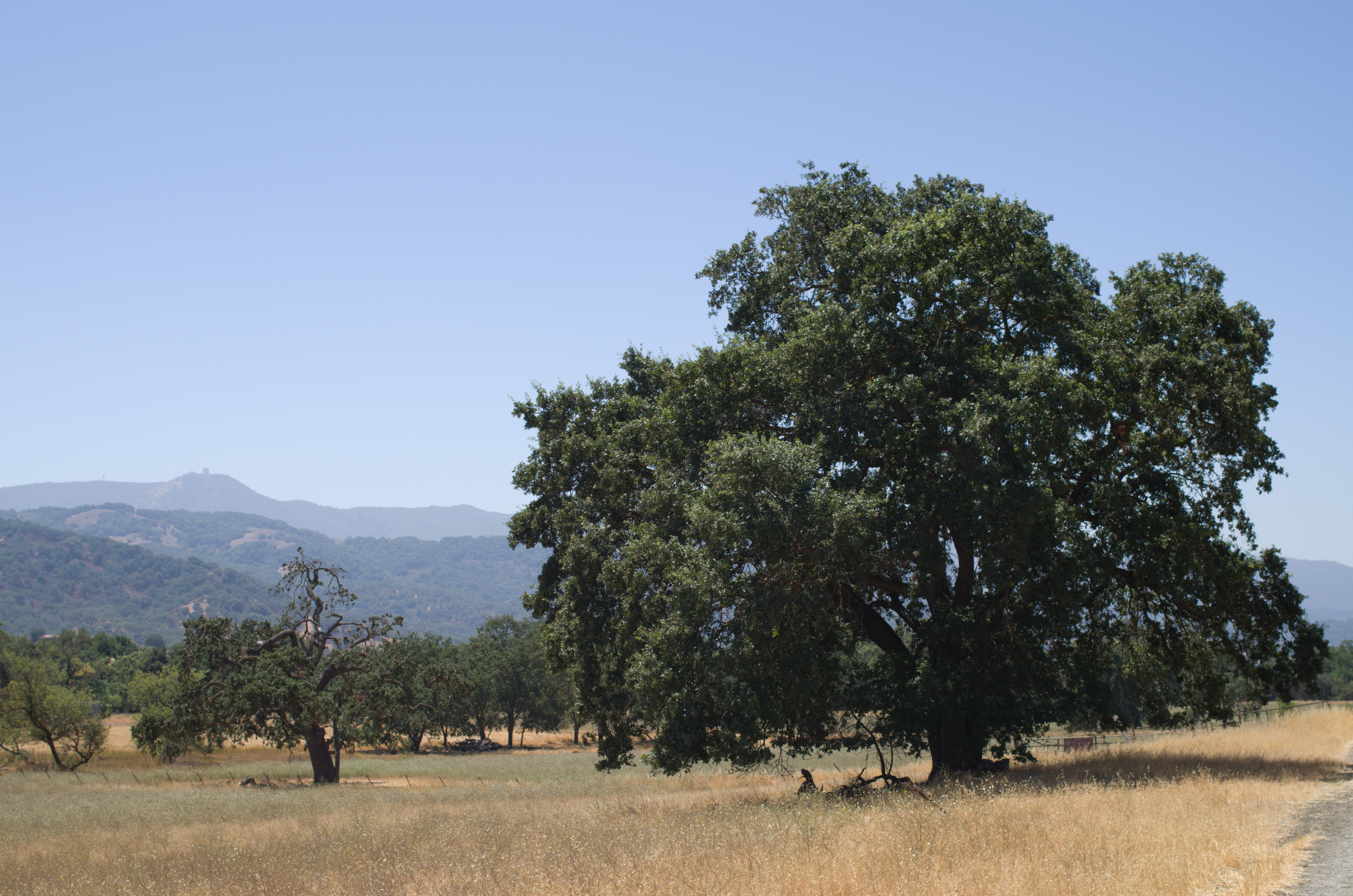
The trail begins on a high point and is the first real ridge on my BART route. Immediately ahead is Coyote Peak, identifiable from south San Jose by its radio tower. A gravel service road (which is also the trail) runs down and up some small hills to the peak. It’s worth walking around the top of Coyote Peak to take in the scenery. To the north the view commands almost all of the Santa Clara Valley. Downtown San Jose is visible, and if the weather is clear the Bay can be seen as well. To the west are the higher ridges that the BART eventually rises to, and to the east in the valley below is Coyote Creek and Metcalf Lake in the section I just completed.
At the turn-off near the peak the trail runs down and around to the north side of the peak before heading west toward the center of the park. A few trails meet up here, including some of the approaches from lower down in the park and the Ridge Trail. This is not the Bay Area Ridge Trail, but it could be combined with the rest of the Hidden Springs Trail as a longer loop in front of this section and meet the rest of the BART in the middle of the park.
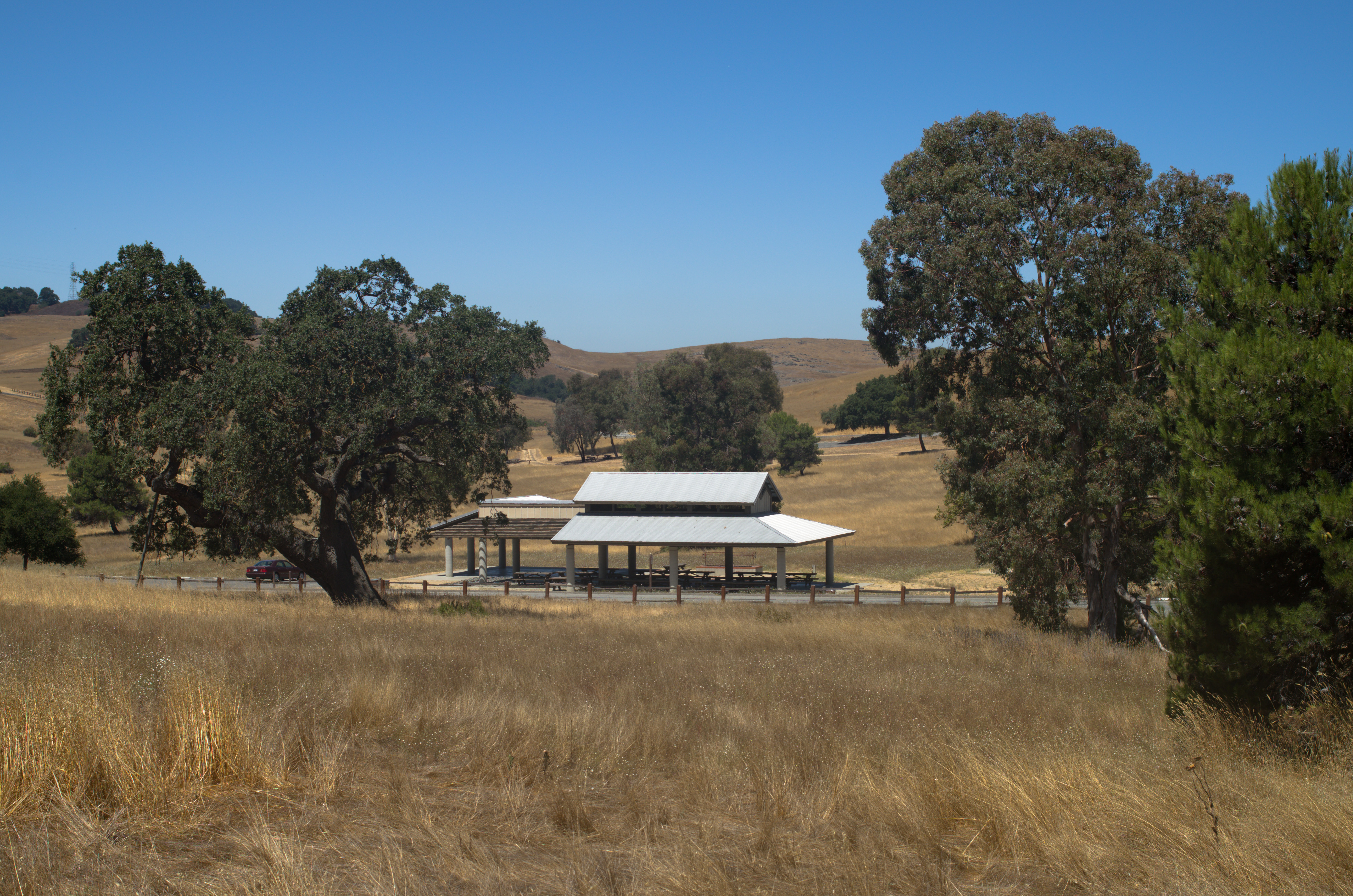
The heart of Santa Teresa Park is the picnic area. It is set a bit down in the hills and provides the most pleasant spot in the park. There are almost no signs of the city just over the ridge and it is quite peaceful. This was my first visit to this park, and while it does not offer much in the way of wilderness, I appreciate the fact that it is relatively close to the city but provides this quiet natural setting. The picnic area is also the only location to get water or use restrooms in this section of the BART.
From here the trail leads up and close by the IBM research facility that is set up in the hills here. Most of the Stile Ranch Trail actually runs on IBM’s property and they permit it as a sort of extension to the park. In contrast to much of the trail so far, it is narrower and runs through several switchbacks. Straying off the trail would be trespassing on IBM land, so simply follow it as it heads down and through a small valley before going over a hill and then down to the edge of the park.
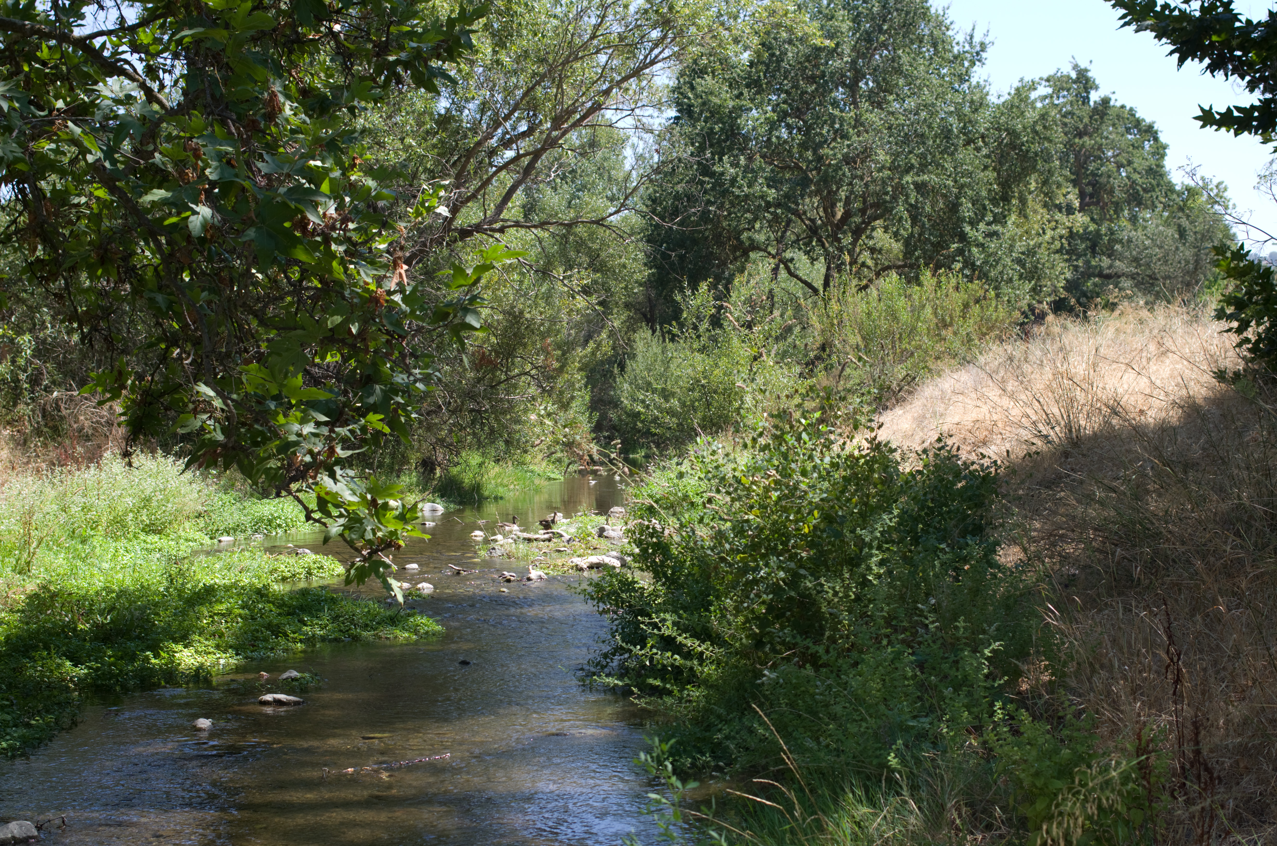
Once outside Santa Teresa County Park, the trail sticks to the fenceline for about half a mile before turning west and becoming a tree-lined walkway along Calero Creek. Upon reaching Harry Road, the paved trail runs next to the road, although there are in most places parallel sections that run closer to the creek itself.
At Singer Park (and across from the tiny playground of Carrabelle Park) is the junction with Alamitos Creek. The BART turns and follows this creek back toward McKean (which is the same street as Harry Rd after a stoplight). Here there are paved trails on either side of Alamitos Creek, and again trails that run closer to the water. Alamitos Creek seems to have slightly fewer trees along its banks, so views of the creek are a bit easier from whichever side you choose.
Where the trail ends at McKean the connection to the next section of the BART is easily walked by continuing on the sidewalk of McKean. McKean then becomes Mockingbird Hill Lane before it narrows and climbs into Almaden Quicksilver County Park.